
Habitat Mapping of Ecosystem Services
A brief overview
The LifeWatch ERIC Thematic Working Group (WG) on Habitat Mapping of Ecosystem Services brings together researchers, practitioners, and policymakers to advance habitat-based approaches for assessing and visualising ecosystem services. Mapping ecosystem services helps illustrate their supply, demand, spatial distribution, trends, and pressures, providing vital insights for sustainable management and policy support.
The WG aims to strengthen methodologies that link ecosystem services to habitat types, ensuring a scientifically robust foundation for mapping efforts. By promoting the use of diverse techniques, including remote sensing, GIS modelling, the use of policy-relevant indicators, stakeholders engagement, citizen science, and field surveys, the group fosters innovative and scalable solutions for ecosystem service mapping across different contexts, including different classification methods, and regions. This includes the mapping of ecosystem service supply and human demand, which is crucial to plan adequate ecosystems management, restoration actions, or to inform policymakers and other interested parts.
A core mission of the WG is to facilitate knowledge exchange, support harmonised practices, and encourage collaboration between sectors. The group offers a platform for sharing tools, data sources, case studies, and operational frameworks that improve the accuracy, usability, and policy relevance of ecosystem service maps.
Aligned with the goals of LifeWatch ERIC, the WG emphasises the importance of transparency, comparability, and usability of outputs to inform EU strategies such as the Biodiversity Strategy and Nature Restoration Law, as well as the UN principles and commitments.
Throughout workshops, working sessions, and community engagement, the WG supports co-development of practical mapping approaches that bridge science, policy, and practice. Stakeholders from academia, government, NGOs, and industry are encouraged to contribute and collaborate toward building effective, evidence-based habitat maps for ecosystem services that support better decision-making and long-term sustainability.
Join us in shaping the future of ecosystem service mapping through habitat-based approaches. Stay connected for updates, resources, and collaborative opportunities. Let’s co-develop solutions that make ecosystem services visible and actionable.
Need help joining? Check our FAQs
Key Objectives
- Identify supply and demand for ecosystem services most relevant for targeted actions (e.g., biodiversity conservation, restoration planning, climate change response), and assess current mapping coverage within LifeWatch ERIC.
- Ensure mapped services and associated data are accessible via the LifeWatch ERIC Marketplace.
- Collect mapping needs from WG members and stakeholders to guide the expansion of datasets and prioritise efforts to fill spatial and thematic gaps.
- Promote harmonisation of methodologies by reviewing and aligning mapping standards, classification systems, and indicators across members.
- Encourage the integration of advanced techniques such as remote sensing, GIS modelling, and machine learning for scalable, habitat-based ecosystem service mapping.
- Support methodological innovation through joint development and testing of mapping approaches, especially linking ecosystem service supply and demand.
- Organise regular workshops, webinars, and training sessions to exchange know-how, share case studies, and build technical skills among members.
- Create a shared repository of guidance documents, tools, templates, and data resources accessible to WG members and broader communities.
- Facilitate cross-sector learning and foster interdisciplinary collaboration among ecologists, data scientists, spatial planners, and policymakers.
- Develop policy-relevant use cases demonstrating the application of habitat-based mapping in supporting EU strategies (e.g. Biodiversity Strategy, Nature Restoration Law).
- Engage with policymakers and practitioners to co-design outputs that are directly usable in planning, reporting, and restoration initiatives.
- Promote the WG’s work as a model for ecosystem-based planning, reinforcing LifeWatch ERIC’s role in supporting science-policy interfaces.
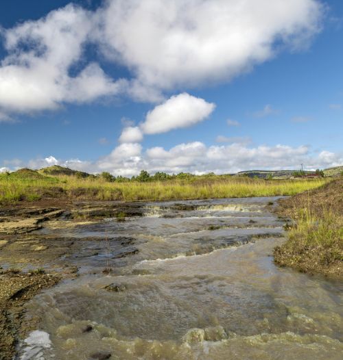
Photo by Ndumiso Mvelase