
Online, 16 October 2025
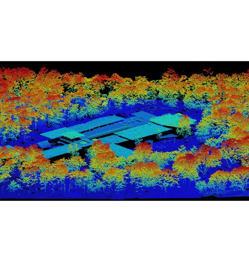
This webinar will explore how to measure and map vegetation structure using airborne LiDAR, in ecological and biodiversity research, following examples from European countries and nature reserves.
The one-hour session will be held online on Thursday 16 October and is organised by the MAMBO Project, which aims to propose modern approaches to biodiversity monitoring. It invites ecologists, reserve managers, biodiversity consultants, environmental practitioners, scientists and anyone with an interest in land-use planning, conservation, and ecosystem monitoring.
Starting with an introduction to airborne laser scanning technology, MAMBO will highlight and share resources on its potential practical applications in ecology, such as measurements of large herbivores’ trail networks, mapping of the spatial distribution of 3D vegetation structures and of individual trees, as well as trees identification.
Visit the MAMBO Project website to learn more about this event and registration (which is limited to 300 participants): https://www.mambo-project.eu/events/webinar-measuring-vegetation-structure-airborne-lidar
Picture source: https://www.mambo-project.eu